Powerful Snowstorm To Wallop Midwest To Interior Northeast
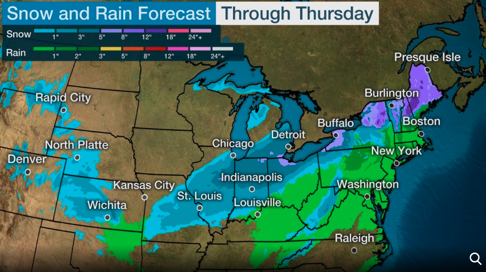
A powerful storm system is cutting across the country early this week, bringing a mix of winter precipitation to parts of the Plains, Midwest, and interior Northeast through Thursday, reported The Weather Channel.
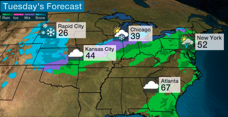
The winter storm is expected to impact the Northern and Central Plains on Tuesday. A wintery mix to rain is also moving through the mid-Mississippi Valley.
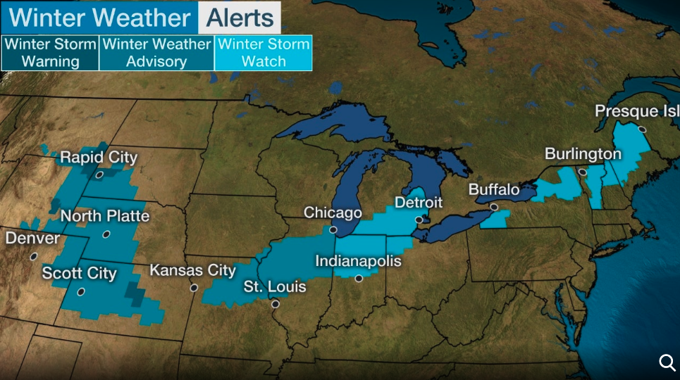
Winter storm watches and warnings have been posted by the National Weather System (NWS) for many regions, including Scott City, Kansas; St. Louis, Missouri; Detroit, Michigan; Upstate New York, and Maine.
The trajectory of the storm is expected to shift southward Tuesday into parts of the Midwest and Great Lakes, before moving into interior Northeast on Tuesday night.
Though there is still a good deal of uncertainty, we are monitoring the potential that some severe threat may materialize around Monday across portions of the southern Plains, and continue into parts of the lower MS Valley by Tuesday. pic.twitter.com/EuFZFpXVD6
— National Weather Service (@NWS) February 25, 2020
Accumulating snowfall is likely for Central and Northern Plains into the mid-Mississippi Valley and southern Great Lakes on Tuesday and into the overnight.
Rain and snow will begin to overspread portions of the Upper Midwest tonight, with a transition to all snow by Tuesday.
Visit https://t.co/VyWINDBEpn for the latest on what to expect in your area. pic.twitter.com/NE8L0Xx9xj
— National Weather Service (@NWS) February 24, 2020
By Tuesday night, a wintery mix is possible in western and northern New York and northern New England.
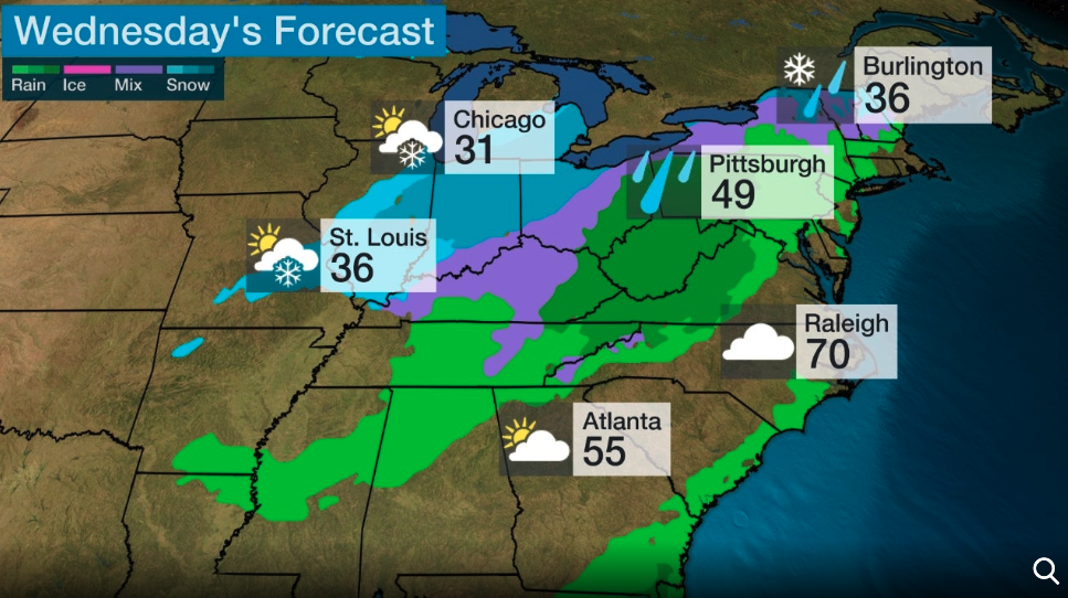
NWS is already indicating that parts of eastern Missouri to Illinois, southern Michigan, and northwestern Ohio, could see deteriorating travel conditions through Wednesday. High winds and drifting snow could become an issue for the region into the evening. Rain and a wintery mix will change over to snow for the Ohio Valley on Wednesday as a cold blast of air will be seen.
By Wednesday night, rain and a wintery mix will change over to mostly snow for the interior Northeast.
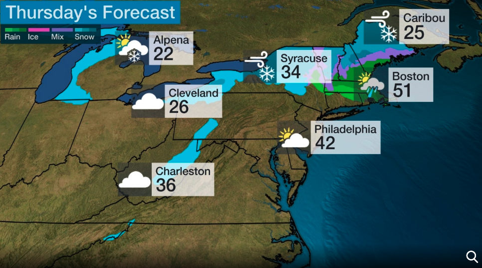
Heavy snow for upstate New York, New England, and Maine is expected on Thursday with rain for southern New England.
Snow totals by Thursday could be around 6 inches for east-central Illinois to northern Indiana, southern Michigan, and northwest Ohio. Portions of upstate New York to most of interior Maine could see upwards of 8 to 12 inches of snow.
NWS shows snowfall accumulation probabilities are the greatest in Midwest and interior Northeast.
This map shows the forecast snowfall accumulation through Friday morning. Snow will begin to develop today across portions of the Midwest and spread into the Northeast over the next couple of days. Check https://t.co/VyWINDBEpn for the latest in your area. https://t.co/IE86WMAi4v pic.twitter.com/QglIgoES69
— National Weather Service (@NWS) February 25, 2020
Tyler Durden
Tue, 02/25/2020 – 14:10
