Isaias Makes Landfall In Carolinas, Sets Eyes On Mid-Atlantic States
Tyler Durden
Tue, 08/04/2020 – 09:25
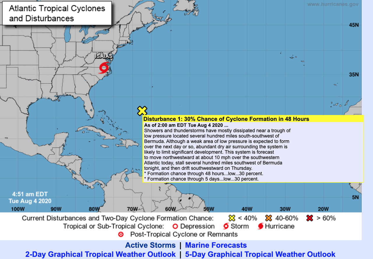
Isaias topped sustained winds of about 85 mph Monday, right before making landfall in Ocean Isle Beach, North Carolina, around 23:00 ET. The hurricane was downgraded Tuesday morning to a tropical storm, set to unleash torrential rains and high winds across Mid-Atlantic and Northeast states, reported the National Hurricane Center (NHC).
After making landfall in the Carolinas, now inching up the East Coast, and fast approaching Maryland, Delaware, New Jersey, and New York, Isaias is set to arrive in southern Maryland to the Washington, D.C. area around morning rush hour.
Washington, D.C., Baltimore, Philadelphia, and New York City are expected to face tropical storm conditions throughout the day on Tuesday. Interstate 95 corridor from Richmond, Virginia, to New York could see wind gusts around 45-65 mph, heavy rains, and elevated flash flooding risks.
CNN quoted Ross Dickman, a meteorologist at the National Weather Service (NWS) in New York, who said Isaias is expected to be one of the strongest storms seen in the Northeast in years.
“The wind and flooding impacts from Isaias will be similar to what the city has seen from some of the strongest coastal storms,” such as nor’easters — “but we haven’t seen one this strong in many years,” he said.
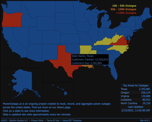
PowerOutage.US is reporting 364,026 customers are without power in North Carolina and 77,649 in Virginia. Widespread power outages are expected across the Mid-Atlantic area on Tuesday.
Tornado watches have been posted for Virginia, Maryland, Deleware, and southern parts of New Jersey.
Tornado threats in New York City could surge later in the day.
The latest European Centre for Medium-Range Weather Forecasts (ECMWF) suggests the storm will head into the interior Northeast.
There’s one town in Maryland, called Ellicott City, that is prone to some of the craziest flash flooding in the country. We reported a couple of years ago, a storm wiped out the historic town. Residents spent Monday filling sandbags as they fear another flash flood could be seen Tuesday.
#Isaias Preps Underway in Ellicott City, MD tonight >>
• Parts of the city submerged in 2016 and 2018…
• This is Main Street, where the sandbags are out
• Parking will be banned on Main for 24 hours starting 11PM, in case catastrophic flooding returns @WUSA9 #DCwx pic.twitter.com/NRemSlnTeY— Mike Valerio (@MikevWUSA) August 3, 2020
Another disturbance has been spotted behind Isaias.
The 2020 Atlantic Hurricane Season has already been off to a busy start.


